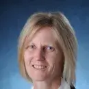
Kristine M. Larson
Kristine M. Larson is a geodesist known for developing innovative ways to use GPS signals to study the Earth. She was a professor of aerospace engineering sciences at the University of Colorado from 1990 through 2018 and is currently a professor emerita.
Larson’s research group at the University of Colorado initially worked on high-precision GPS applications for geoscientists. They made some of the first applications of the GPS technique to study plate boundary deformation, global plate tectonic motions, glacial isostatic adjustment, and episodic slip. Her group subsequently pioneered the use of GPS data for measuring seismic displacements. She developed similar methods to make the first precise measurements of ice sheet speeds in Greenland. Removing reflected signal errors in seismic studies led to the development of GPS Interferometric Reflectometry (GPS-IR). This new technique uses reflected GPS signals (and now signals from all four Global Navigation Satellite Systems, GNSS-IR) to measure near-surface soil moisture, snow accumulation, vegetation water content, permafrost melt and water levels. Uniquely GNSS-IR is based on off-the-shelf instrumentation used by geodesists and surveyors and thus can be widely applied. Most recently she led the development of open source software for GNSS-IR users.
Larson received a B.A. in engineering sciences from Harvard University and a Ph.D. in geophysics from the Scripps Institution of Oceanography.